
LAG
‘Lasgidi.’


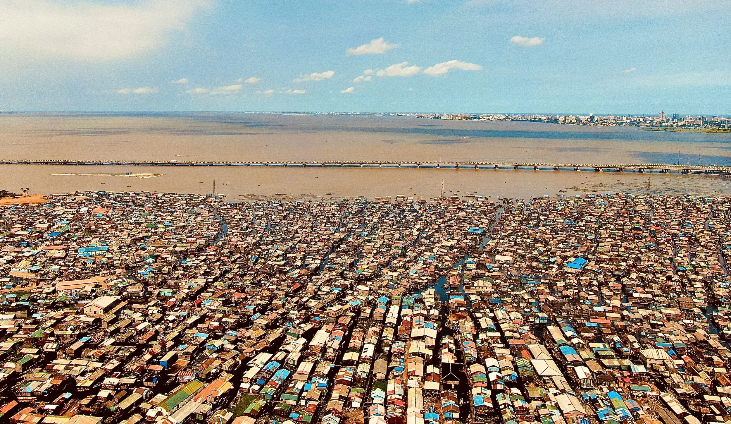
The city of Lagos developed in Nigeria around a lagoon in the Gulf of Guinea on distinctive land areas separated by water.
With its indigenous population and natural resources, urbanisation has soared – with increased enlargement of informal areas.
Land reclamation has also greatly increased its external perimeter, and with the adjoining facility of Port Lekki.
Maps of Lagos
Overview
Streets and Networks
Satellite View
All maps above provided courtesy of Google Maps.
Population Density
Visualising population density in Global Cities
This interactive map shows population density in 2020, measured in residents per square kilometre.
The data is from the ‘Global Human Settlement Layer’ (GHSL) 2023, produced by the European Commission JRC and the ‘Center for International Earth Science Information Network’ at Columbia University using earth sensing data from the European Copernicus Space Program that Integrates high volumes of satellite data with national census data.
The GHSL describes the settlement geography of the entire globe and has applications for a wide range of research and policy issues related to urban growth, development and sustainability.
Map provided courtesy of LuminoCity3D.org.
Rail Networks
Rail and transport networks in Global Cities
The above map represents the urban metro and light rail network of the city and immediate suburbs. This shows individual rail routes and the level of connectivity for urban travellers across the expanding city’.
Map provided courtesy of UrbanRail.net.
Journals
23. Lagos + extract (Ademide Adelusi-Adeluyi)

“In the early 19th century, in the Bight of Benin – an approximately 400 mile stretch of coastline beginning at Cape Paul, in present day Ghana, spanning the coasts of Toga and the Republic of Benin, and ending at the outlet of the Niger River in contemporary Nigeria was a time of internecine conflict…”


