CPT
‘Mother City.’


Cape Town is stunningly located with the backdrop of Table Mountain and Devil’s Peak, near the Cape of Good Hope in the Republic of South Africa.
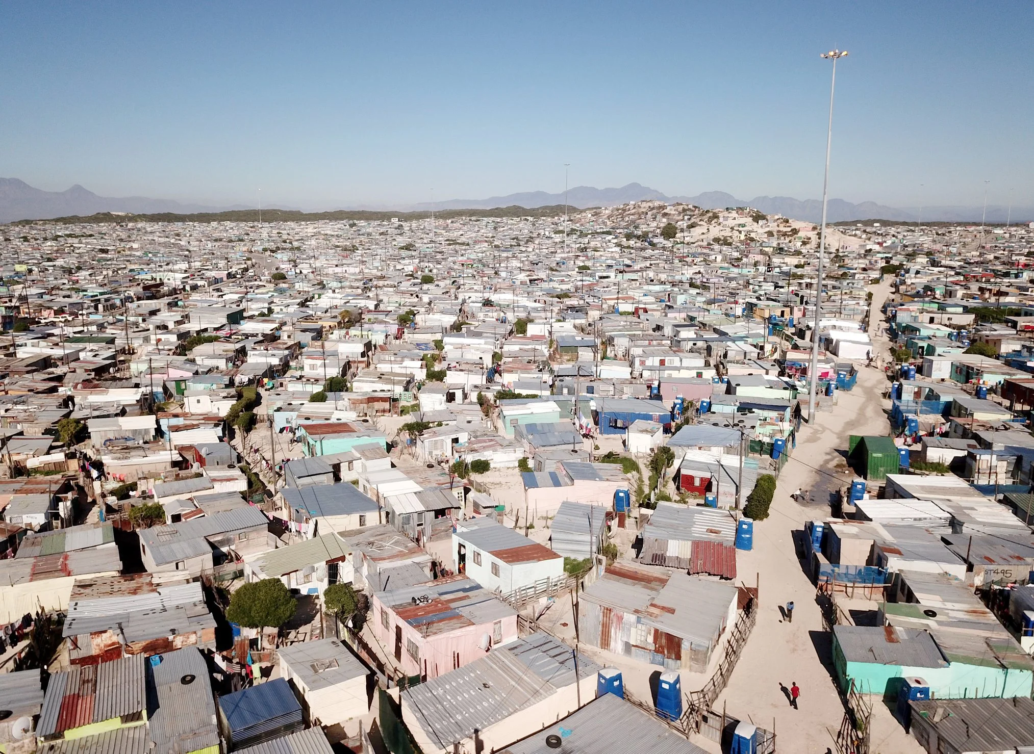
With a natural harbour in Table Bay, the centre of the city was established around a formal grid. Now extending outwards organically, there are many densely populated areas and townships but which are poorly serviced having only basic facilities.

Maps of Cape Town
Overview
Streets and Networks
Satellite View
All maps above provided courtesy of Google Maps.
Population Density
Visualising population density in Global Cities
This interactive map shows population density in 2020, measured in residents per square kilometre.
The data is from the ‘Global Human Settlement Layer’ (GHSL) 2023, produced by the European Commission JRC and the ‘Center for International Earth Science Information Network’ at Columbia University using earth sensing data from the European Copernicus Space Program that Integrates high volumes of satellite data with national census data.
The GHSL describes the settlement geography of the entire globe and has applications for a wide range of research and policy issues related to urban growth, development and sustainability.
Map provided courtesy of LuminoCity3D.org.
Rail Networks
Rail and transport networks in Global Cities
The above map represents the urban metro and light rail network of the city and immediate suburbs. This shows individual rail routes and the level of connectivity for urban travellers across the expanding city’.
Map provided courtesy of UrbanRail.net.
Journals
11. Cape Town + extract (Jan Morris)

‘It was the Portuguese explorers that first sailed past the southern tip of Africa naming it ‘Cabo da Boa Esperança’. With a natural harbour in Table Bay beside Table Mountain, next the Dutch East India Company (VOC) settled Kaapstad (Cape Town) in 1652 with its grid of streets until the British took control of Cape Colony and started to shape the city after the 1814 Anglo Dutch Treaty.’