
17. São Paulo
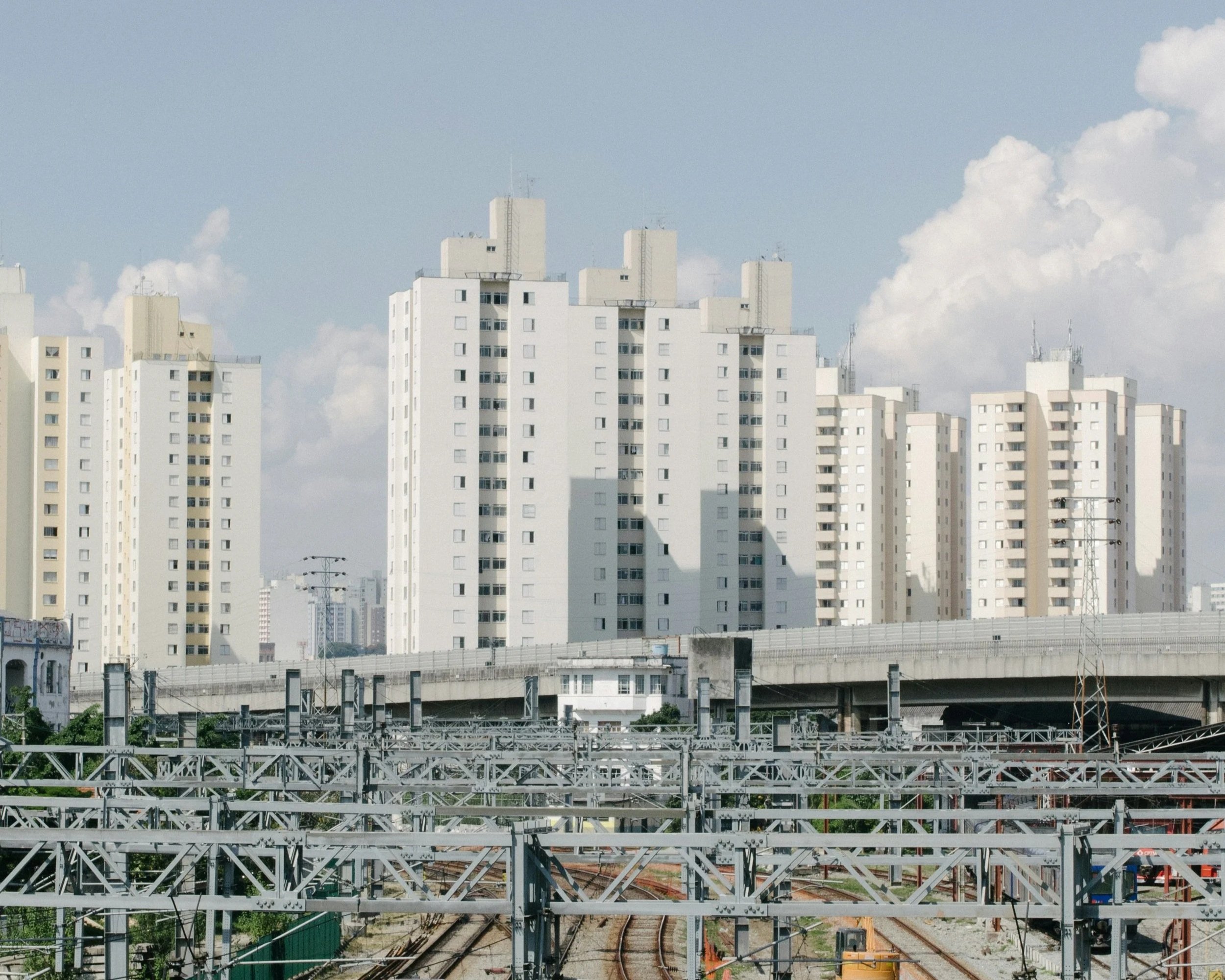
Upon arrival, the modern city of São Paulo is perceived as one of the most strikingly dense vertical cities in the world.
With skyscrapers built on seemingly every available piece of land, whether flat or sloping, they rise skywards at increasing density.
“São Paulo was founded in 1554 by Jesuit missionaries. It was one of the few cities in colonial Portuguese America located away from the coast. Several aspects of the inland topography attracted them to the site. Most important was its location at the convergence of the Tietê, Pinheiros, Anhangabaú and Tamanduateí rivers. The four rivers that converge on São Paulo ultimately helped shape the geography of Brazil. São Paulo residents, known as ‘Paulistas’, followed these waterways deep into the interior of the new continent in search of precious metals and Indian labourers for their farms... It was the São Paulo coffee boom that unleashed a flood of foreign investments in Brazilian infrastructure and this in turn led to the construction of key transportation links, such as the railway that climbs the steep coastal escarpment from the port city of Santos to the São Paulo plateau. This facilitated not only the export of coffee, but also the influx of more than 5 million new immigrants from regions all over the globe.
São Paulo expanded rapidly with the coffee economy. A new class of wealthy Paulistas known as the ‘coffee barons’ emerged during this period and they invested heavily in the urban landscape… Architect Ramos de Azevedo designed the Luz train station, the Municipal Theatre, the Municipal Market and the Liceu de Artes. He was also instrumental in the design and construction of a grand new boulevard which would eventually eclipse the city centre as the true heart of São Paulo. Avenue Paulista was inaugurated in 1891 – the long boulevard where residents would have ample space to build their mansions… Avenue Paulista soon became the focus of São Paulo power in society. The City Council prohibited construction of factories along it, in effect, passing one of São Paulo's first zoning laws. Dozens of mansions were built along the tree-lined boulevard. The Trianon Belvedere, a terraced garden with a spectacular view of the Anhangabaú River Valley, was built then. One of the São Paulo’s first major engineering projects, the ‘9 de Julho Tunnel’ was built under the Trianon to connect the new residential areas to the city centre… Avenida Paulista became home to over 200,000 apartment dwellers and hundreds of businesses plus the huge daily influx of pedestrians and motor vehicles. This historic boulevard remains the true heart of the city.” *
As described, inland from the port of Santos, its vertical buildings are complemented by its horizontal arteries, congested daily with its mixed traffic seeking paths in and around the city.
Some elevated and some bored underground, these expressways provide the nexus of the core of the capital of São Paulo State with inter-weaving paths both above and below ground.
So dense and so complex, Greater São Paulo is defined now within the ‘São Paulo Macro-Metropolis’, a region encompassing over 30 million people that include the metropolitan areas of Campinas, Guarulhos, Baixada Santista, Sorocaba and Vale do Paraiba e Litoral Norte.
As a highly urbanised region comprising a series of poly-nodal centres, it constitutes one of the largest urban economies in South America. It has particular challenges of water resources, pollution and informal settlement that remain severe in its congested urbanised environment.
*Elizabeth Johnson – São Paulo - Great Cities in History – Thames & Hudson, 2009.